Theth National Park is a protected mountain area in the Albanian Alps, established in 1966 and covering 2,630 hectares of peaks, forest and river valley around the village of Theth. In January 2022 it was merged with Valbona Valley National Park and the Gashi River reserve to form the much larger Alps of Albania National Park. This guide explains what the park protects — its geography, rivers, forests and rarely-seen wildlife — and how to tread lightly while you are there.
For the walks that take you through it, see our best hikes in Theth guide.
Theth National Park at a glance
| Detail | |
|---|---|
| Established | 1966 |
| Original area | 2,630 ha (~1,680 ha forested) |
| Mountain range | Prokletije / Accursed Mountains |
| Main river | Shala River |
| Geology | Limestone karst |
| 2022 change | Merged into the Alps of Albania National Park |
| Combined park | Over 82,000 ha (with Valbona Valley NP + Gashi reserve) |
The short version: the park was created in 1966 to protect the Theth valley and its surrounding peaks, and since 2022 it has been one component of a single, much larger Albanian Alps park. For visitors, the practical point is that this is a protected landscape with fragile karst, forest and wildlife — enjoy it, but leave no trace.
The geography: peaks, karst and the Accursed Mountains
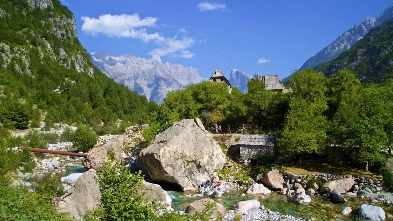
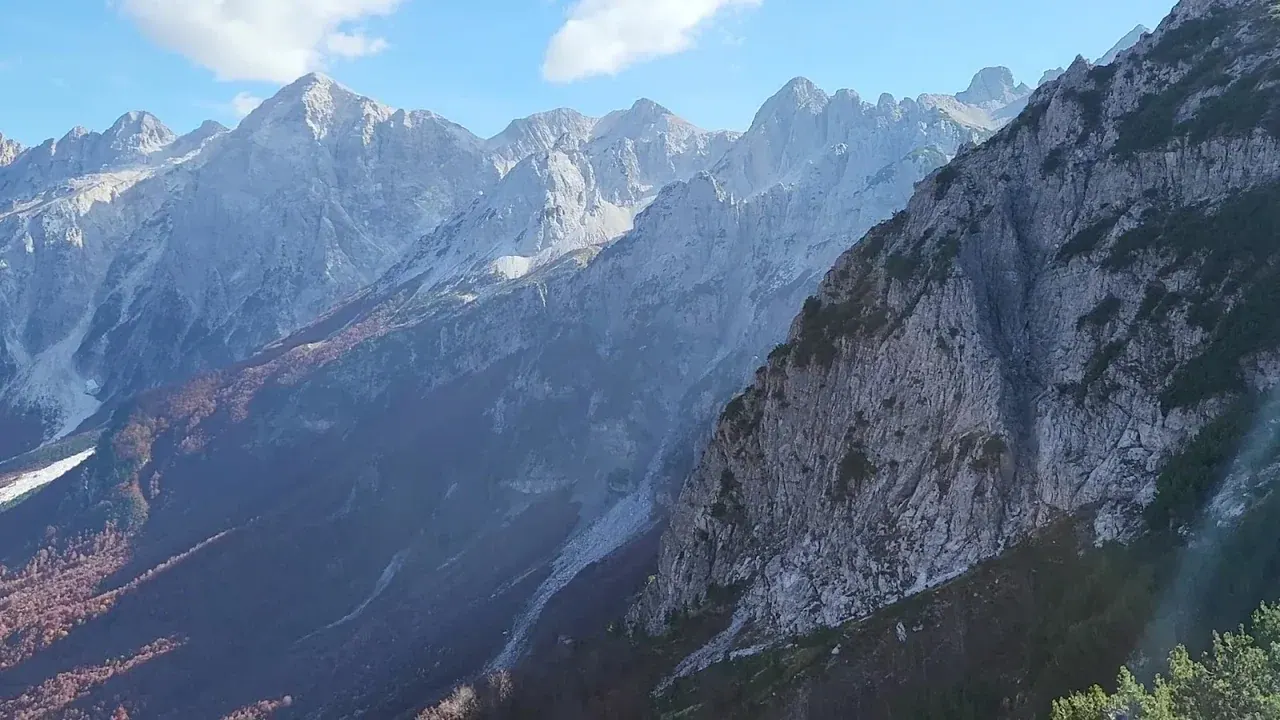
Theth sits deep in the Prokletije, the range better known in English as the Accursed Mountains — a wall of grey limestone peaks straddling the borders of Albania, Montenegro and Kosovo, holding most of Albania's summits above 2,000 m and crowned by Maja e Jezercës (2,694 m) — the highest peak of the whole Dinaric Alps, and the highest summit lying entirely within Albania. Both local names — Albanian Bjeshkët e Nemuna and Montenegrin Prokletije — literally mean the "cursed" or "damned" mountains. The origin is disputed, but the best-loved legend tells of a mother fleeing enemies with her children across this waterless, scorching rock who, mad with thirst and despair, cursed the range barren and treacherous. The park protects a dramatic slice of it: steep forested flanks rising to bare rock ridges, high passes such as Valbona and Peja, and the enclosed bowl of the Theth valley itself.
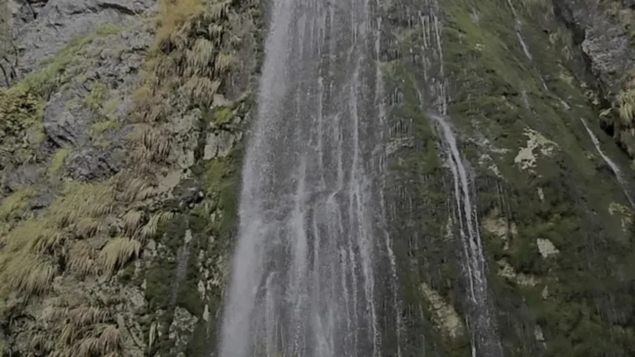
The valley's broad, flat floor and steep sides are the signature of ice-age glaciers, which ground out the classic U-shaped trough you walk through today. Into that the limestone karst has worked the detail: water sinks through the porous rock and re-emerges lower down as powerful springs — the same geology that produces the famous Blue Eye and the plunge of Grunas Waterfall — leaving a landscape of caves, sinkholes, sudden gorges and startlingly clear water.
The Shala River and the valley's water
The valley is drained by the Shala River, which gathers the meltwater and spring flow of the surrounding peaks and carves down through the rock towards the lower valley. In its upper reaches it feeds the meadows around the village; further down, near Nderlysa, it has scoured the pale "stone groves" — smoothed rock pools and a narrow canyon — before the spring at the Blue Eye adds its cold, vivid turquoise flow. The park's water is its signature: cold, clear and, at the Blue Eye, holding a temperature of only around 5–8 °C year-round.
Forests, flora and fauna
Roughly two-thirds of the original park is forest — beech on the lower and middle slopes, with conifers and dwarf mountain pine higher up, giving way to alpine meadow and bare karst near the tops. In early summer the meadows bloom, and the mix of altitudes and the limestone soil support a rich variety of mountain plants — the wider Prokletije is reckoned the richest range in the Balkans for flora, with over 1,700 plant species and around 50 endemics found nowhere else, a botanical refugium that has held onto plants long lost elsewhere in Europe.
The park is also home to some of Europe's most iconic large mammals, though you should not expect to see them — they are shy, few in number and keep to the remotest ground. The list includes:
- Brown bear
- Grey wolf
- Eurasian lynx — here the critically endangered Balkan lynx (Lynx lynx balcanicus), one of Europe's rarest cats, with only a few dozen left across the whole region
- Chamois and wild goat
- Roe deer
Sightings are rare, and that is a sign of a healthy, wild place rather than a poor one. Birds of prey ride the thermals above the ridges, and the rivers hold trout. If you want to understand the water features these animals live among, see our Blue Eye of Theth guide and Grunas Waterfall guide.
Protected status and what the 2022 merger changed
The park has been protected since 1966, one of Albania's older national parks. The big administrative change came on 26 January 2022, when the government combined Theth National Park with Valbona Valley National Park (established 1996) and the Gashi River Strict Nature Reserve to create the Alps of Albania National Park — a single protected area of about 82,844 hectares (roughly 828 km²) — Albania's largest national park.
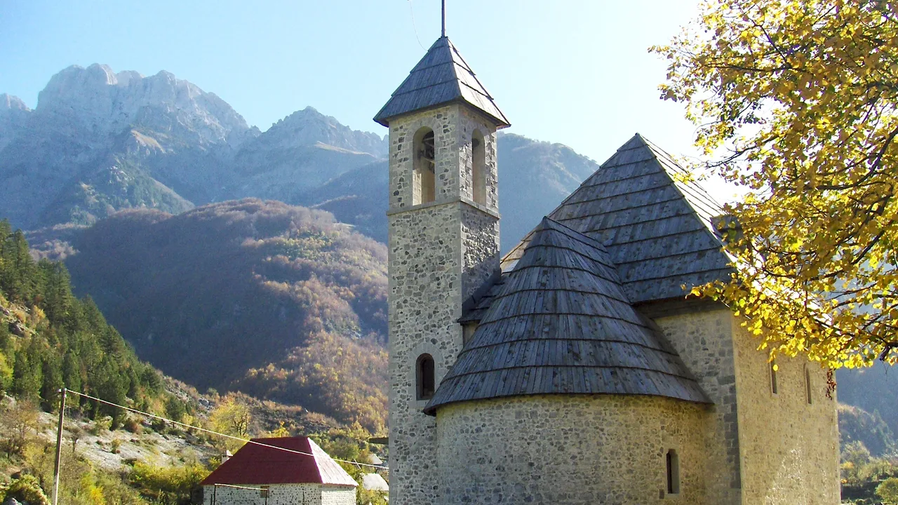
For you as a visitor, day-to-day little changes: you still walk the same trails, stay in the same valley guesthouses and pay the same municipal accommodation tax to your host. But the merger reflects a push to manage the whole Albanian Alps ecosystem — peaks, forests, rivers and wildlife corridors — as one connected landscape rather than isolated pockets.
Leave no trace
A protected karst valley is easily damaged and slow to recover, so travel responsibly:
- Carry out all your rubbish — there is no waste infrastructure in the valley, and litter is a growing problem on the popular trails.
- Stay on marked paths to avoid trampling meadows and eroding fragile slopes.
- Do not disturb wildlife or livestock, and give any animal a wide berth.
- Do not swim with sunscreen or soaps in the Blue Eye and river pools — they pollute the cold, clear water.
- Keep noise down; part of the point of a place this remote is its quiet.
Guided walks are a good way to learn the park's ecology from people who live in it — browse options on our activities page, and see the valley's headline sights on our landmarks overview.
How to explore the park
You do not need a permit to walk the park's day trails from Theth, and the network of marked paths lets you see a great deal of it on foot. The classic outings each show a different face of the protected landscape: the easy forest walk to Grunas Waterfall for the karst-fed cascade, the long valley route down to Nderlysa and the Blue Eye for the river and its spring pools, and the high crossings over the Valbona and Peja passes for the bare-rock alpine zone and the big views. Between them you cover forest, meadow, river and summit — the full range of habitats the park exists to protect. For the walking itself, our best hikes in Theth guide lays out the options by difficulty.
One thing worth knowing: crossing the high passes into Montenegro or Kosovo takes you onto international-border routes that require a cross-border permit arranged in advance, quite separate from the national-park status itself. A simple up-and-back day hike from Theth needs no such paperwork, but a through-trek does — plan those carefully.
Best time to visit the park
The park is at its most accessible and rewarding from roughly late spring to early autumn, when the snow has cleared from the trails and the guesthouses are open. Early summer brings full rivers and flowering meadows; midsummer is warmest and busiest; and the shoulder weeks are quieter, with cooler air and softer light. In winter the valley is largely snowbound, the road over Qafa e Thorës is often blocked, and most accommodation closes, so a winter visit is a serious undertaking to be planned and verified in advance rather than a casual trip. For the seasonal detail, see best time to visit Theth.
Whenever you come, remember that this is a lived-in landscape as well as a protected one: the valley's farmers still graze animals and cut hay across ground that has been worked for generations. Respecting that — closing gates, keeping dogs and children away from livestock, and treating homesteads as the private places they are — is as much a part of visiting the park responsibly as staying on the trails and carrying out your litter.
Frequently Asked Questions
When was Theth National Park established?
Theth National Park was established in 1966, covering 2,630 hectares of the Theth valley and the surrounding Accursed Mountains, of which roughly 1,680 hectares are forest. In January 2022 it was merged with Valbona Valley National Park and the Gashi River reserve into the larger Alps of Albania National Park.
Is Theth still a national park after the 2022 merger?
Yes. Theth remains fully protected — the 2022 change was administrative, combining it with Valbona Valley National Park and the Gashi reserve to form the single Alps of Albania National Park. For visitors, the trails, guesthouses and access are unchanged; the merger simply manages the wider Albanian Alps as one connected landscape.
What wildlife lives in Theth National Park?
The park is home to brown bear, grey wolf, Eurasian lynx, chamois, wild goat and roe deer, along with birds of prey and river trout. All are shy and few in number, so sightings are rare — which is a sign of genuinely wild, healthy habitat rather than an absence of animals.
What is the landscape of Theth National Park like?
It is high limestone-karst country in the Prokletije, or Accursed Mountains — steep beech forest rising to bare rock ridges and high passes, drained by the clear Shala River. The porous rock produces powerful springs, gorges and pools, including the Blue Eye and Grunas Waterfall, and cold, vividly turquoise water throughout the valley.
Why are they called the Accursed Mountains?
Both the Albanian name Bjeshkët e Nemuna and the Montenegrin Prokletije literally mean the "cursed" or "damned" mountains. The origin is disputed, but the most popular legend tells of a mother fleeing with her children across the harsh, waterless range who, overcome by thirst and despair, cursed the mountains to be forever barren and treacherous. Others link the name simply to the terrain's severity and the hardship of living there.