
At a glance
| Detail | |
|---|---|
| What it is | Steep climb to Qafa e Pejës (~1,742 m) — the hardest of Theth's day hikes |
| Distance/time | ~5 km each way (~10 km return) · 1.5–2 h up · ~1,000 m ascent |
| Access | On foot from central Theth, north-west; loose scree, real exposure near the top |
| Water | No reliable spring — carry ~3 L per person |
| Season | June–September, once the snow clears |
| Permit | None for an up-and-back; needed to continue over toward Boga/Montenegro |
| Best for | Hiking, mountain views, Peaks of the Balkans |
The steepest of Theth's day hikes
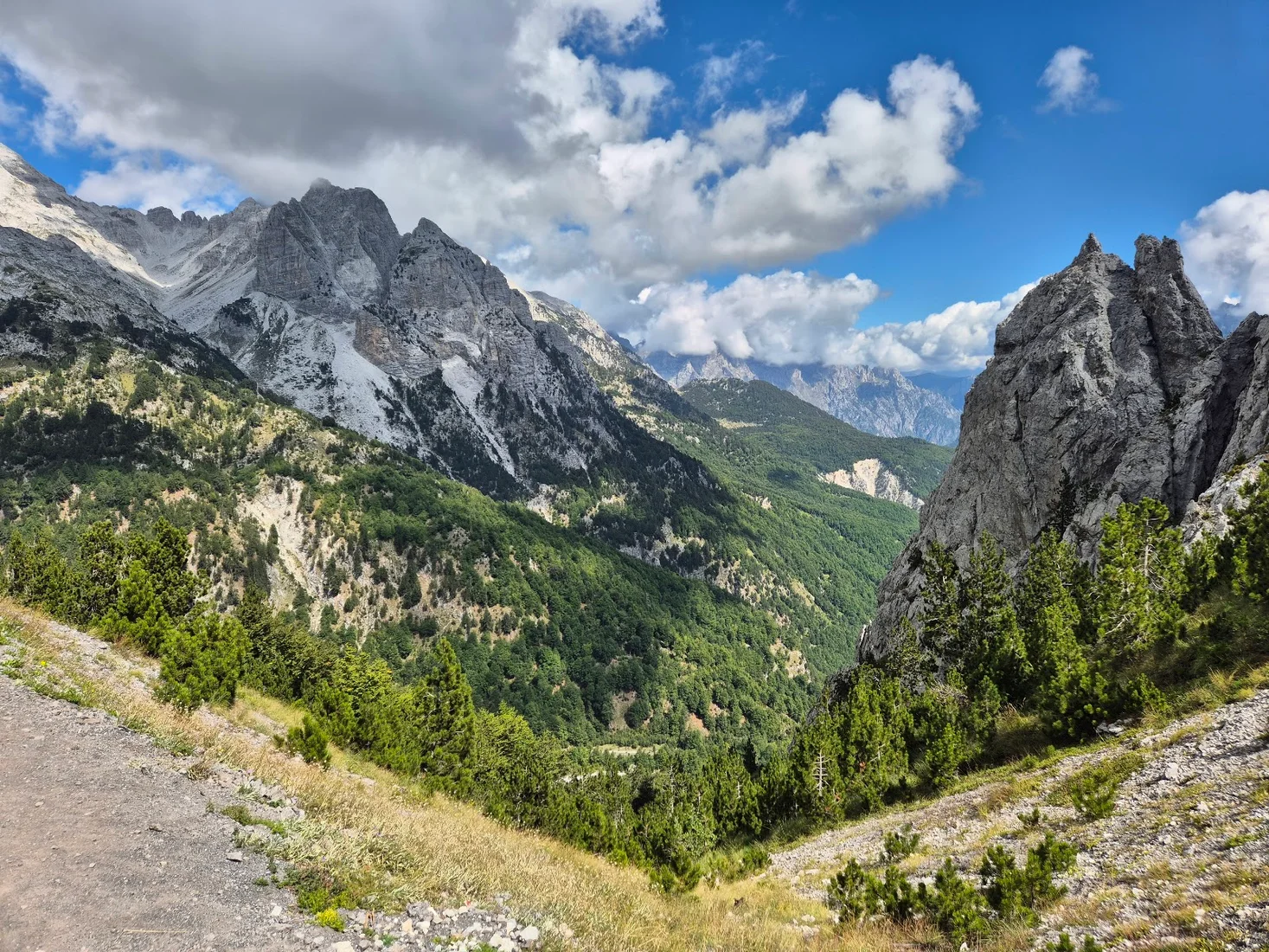
The Peja Pass hike climbs from the floor of the Theth valley to Qafa e Pejës, a high notch in the Accursed Mountains at around 1,742 m, in a steep 1.5 to 2 hours each way over roughly 5 km of trail. It is short, sharp and exposed — a serious half-day out rather than a stroll — and it rewards you with one of the finest close-up views of Maja e Harapit, the pyramid peak known as the "Matterhorn of Albania".
The route starts near the centre of Theth and heads north-west, up the flank of the valley toward the wall of peaks that separates Albania from Montenegro. The lower section works through pasture and thinning beech forest; as you gain height the path steepens into switchbacks across open, stony slopes, and the final pull crosses loose scree with real exposure. Expect around 1,000 m of ascent packed into a couple of kilometres of steep trail.
Toward Boga and beyond
Qafa e Pejës is not just a viewpoint — it is a crossing point on the Peaks of the Balkans trail, the long-distance loop that threads Albania, Montenegro and Kosovo. From the pass the route drops down the far side toward the Montenegrin border and on toward Boga at the western edge of the valley, which is why you will meet multi-day trekkers on the climb, packs and all. If you intend to walk over the pass and out of Albania, you are on an international border route and will need the correct cross-border permit arranged in advance — treat the day-hike-to-the-pass and the border crossing as two very different undertakings.
What to bring
The biggest practical trap is water — there is no reliable spring on the climb, and the south-facing slope bakes in summer. Carry at least 3 litres per person, start at first light in July and August, and pack sun cover, proper boots, layers for the cold pass, and trekking poles for the loose descent. For the full route detail, see our Peja Pass hike guide and the Peaks of the Balkans trail.